EN
EN
Planning a ski holiday for the 2026/27 winter season? Whether you're chasing fresh powder in the Alps, the Sierra Nevada, or Utah's legendary resorts, knowing what to expect from this year's snowfall outlook can make all the difference.
Winter 2026/27 is shaping up to be influenced by a developing El Niño, a climate pattern in the Pacific Ocean that affects global atmospheric circulation. After a La Niña-dominated 2025/26 season that delivered mixed results across the Northern Hemisphere, the Pacific is now shifting rapidly toward warmer conditions. Long-range models from ECMWF, NOAA, and analysis from Severe Weather Europe suggest this could be a moderate to potentially strong El Niño, with major implications for ski regions worldwide.
In this guide, we decode those predictions and translate them into practical insights for skiers, by month and region, so you can plan ahead your ski holiday smarter, earlier, and better.
Europe, USA & Canada winter snowfall predictions
According to NOAA, the IRI (International Research Institute for Climate and Society), and Severe Weather Europe:
La Niña faded to ENSO-neutral by spring 2026, and El Niño is expected to emerge by mid-summer 2026. NOAA gives a 62% chance of El Niño developing by June–August 2026, persisting through at least the end of 2026 and into winter. There is roughly a one-in-three chance the event could reach "strong" status (Niño-3.4 ≥ +1.5°C) by October–December 2026, with some models suggesting the potential for a Super El Niño comparable to the powerful 1997-98 and 2015-16 events. Subsurface ocean temperatures are already well above average across the central and eastern Pacific, a key precursor to strong El Niño development.
Source: NOAA ENSO Diagnostic Discussion, April 2026
(Ref: Met Office)Other key drivers
Jet stream position: El Niño pushes the Pacific jet stream southward, sending more storms toward the southern US, California, and the Southwest, while the Pacific Northwest and Northern Rockies often turn drier. North Atlantic Oscillation (NAO): Still the primary driver of European winter weather. El Niño winters can promote a positive NAO, meaning milder, wetter conditions in northern Europe and potentially less cold air reaching the Alps. Sudden Stratospheric Warming (SSW): Remains a wildcard. SSW events can disrupt the polar vortex and trigger cold spells across both Europe and North America, overriding the El Niño signal temporarily.
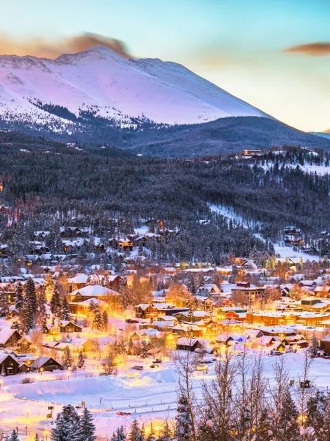
Western US struggled: Colorado hit a record-low snowpack (22% of median by April 1), Utah broke records for the lowest snowpack ever, and California ended at just 18% of average. A persistent high-pressure ridge kept storms away from the Central and Southern Rockies for much of winter. East Coast and Midwest thrived: The Midwest and Northeast experienced one of their best seasons in years, with record snowfall in parts of the Great Lakes and strong conditions in Vermont and New England. Canada was a mixed bag: Interior British Columbia and the Alberta Rockies (Revelstoke, Kicking Horse, Lake Louise) saw their snowiest December on record. Whistler's upper mountain held up, but coastal rain events impacted lower terrain. Europe had a slow start: The Alps saw below-average snowfall through November and December, with conditions improving in January. A late-season dump in early April brought over a metre of fresh snow to parts of the Alps, salvaging the spring season.
The key takeaway? La Niña winters tend to favour the north and penalise the south and west. El Niño is expected to reverse this pattern significantly.
| Month | Snowfall Trend | What to Expect |
|---|---|---|
| November | Average to below average | Slow start likely at lower elevations; high-altitude resorts and glaciers should fare better |
| December | Variable | Storm systems possible but with higher snow lines; the Alps may see rain at lower elevations |
| January | Average to slightly above | Best window for snowfall as the El Niño pattern matures; cold spells possible from SSW events |
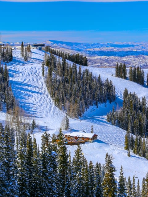
Insights: Historical data shows little consistent correlation between ENSO phase and Alpine snowfall. The 2015-16 Super El Niño delivered poor conditions at lower European resorts but excellent glacier skiing at altitude. The key strategy for 2026/27 is to prioritise altitude: resorts above 2,000 m (6,560 ft) with glacier access are your insurance against warm spells at valley level. Northern Scandinavia may see colder-than-average conditions, offering reliable early-season options. Resorts in meteorologically favourable positions, like St. Anton (Arlberg), which intercepts Atlantic storm systems independently of ENSO, remain strong bets regardless of El Niño.
Top snow-reliable European resorts for an El Niño winter For 2026/27, prioritise high-altitude glacier destinations that have historically performed well regardless of ENSO phase:
Zermatt (Switzerland) — Glacier skiing at 3,883 m, the most snow-reliable resort in the Alps in any ENSO phase. Val d'Isère / Tignes (France) — Glacier terrain above 3,400 m and excellent high-altitude off-piste. Chamonix (France) — Big-mountain variety with high-elevation access. St. Anton (Austria) — Meteorological convergence point for Atlantic storms, consistently high snowfall totals. Obergurgl-Hochgurgl (Austria) — High alpine pistes that preserve snow exceptionally well. Europe late season outlook (Feb-Apr) Late-season forecasting is always uncertain, but El Niño winters have historically produced occasional warm spells interspersed with sudden cold intrusions in the Alps, especially if SSW events or blocking patterns develop. February could still deliver good skiing at altitude. For March and April, glacier resorts such as Hintertux, Zermatt, and Tignes are the most reliable options above 2,000 m (6,560 ft). The Pyrenees had a strong late season in 2025/26 and could surprise again if southerly storm tracks are active.
 (Ref: Met Office)
Storm types to know
| Storm type | Hits best in | Description |
|---|---|---|
| Nordstau | Northern Alps | Cold NW flow storms for Austria/Switzerland |
| Südstau | Southern Alps/Dolomites | Moisture-rich Med lows for Italy |
| Retour d'Est | SE France/NW Italy | Rare, intense easterly snowfall |
| Föhn | Alpine valleys | Warm, dry downslope winds (melts snow fast) |
| Month | Snowfall Trend | What to Expect |
|---|---|---|
| November | Below average in north, variable in south | Slow start in Pacific NW and Northern Rockies; early moisture possible for Sierra and Southwest |
| December | Average to above average in south | California and southern Rockies begin to see increased storm activity; potential for atmospheric rivers |
| January | Above average in south, below in north | Peak conditions expected for Sierra Nevada, Utah, southern Colorado, and Southwest; Northwest drier |
Insights El Niño historically favours the Sierra Nevada, Utah's Wasatch Range, and the southern Rockies (New Mexico, Arizona, southern Colorado) with above-average snowfall, courtesy of the southward-shifted jet stream. The Pacific Northwest (Washington, Oregon), Northern Rockies (Montana, Idaho), and interior British Columbia typically see below-average snowfall in El Niño winters. Resorts like Whistler and Jackson Hole often have disappointing El Niño seasons. The Northeast faces a more variable outlook; El Niño winters tend to lean toward below-average snowfall, though individual nor'easters can still deliver significant storms. California ski resorts are already marketing the potential "Godzilla" El Niño — but skiers should note that even the strong 2015-16 El Niño produced mixed results in the Sierra, with much precipitation falling as rain at lower elevations. Altitude matters.
USA late season outlook (Feb-Apr) If El Niño strengthens as expected, February and March could be very active for California, Utah, and the Southwest, with continued storm activity along the southern jet stream. High-altitude Colorado resorts like Breckenridge, Telluride, and Vail could see improved late-season conditions compared to the disastrous 2025/26 season. For the Northeast, spring skiing at resorts like Killington (VT) depends on whether cold snaps persist into March. After the strong 2025/26 season in the East, expectations should be tempered for 2026/27.
 (Ref: UKMO)
| Month | Snowfall Trend | What to Expect |
|---|---|---|
| November | Below to average | Slower start than 2025/26, when Interior BC set records; warmer temperatures likely |
| December | Below average | Warmer and potentially drier conditions in BC and Alberta; high elevations should still accumulate snow |
| January | Variable | Storm activity possible but with higher snow lines; interior mountains fare better than coast |
Insights Western Canada (BC and Alberta) historically sees warmer, drier conditions during El Niño winters. After the record-breaking December 2025 in Interior BC, skiers should calibrate expectations for a less exceptional start. Whistler Blackcomb, which already struggled with rain events in 2025/26, faces an even tougher outlook if El Niño raises snow lines further. Interior resorts at higher elevations — Revelstoke, Kicking Horse, Lake Louise — are more insulated from the warming effect and remain solid options. Eastern Canada resorts may see more variable conditions, though occasional cold outbreaks can still produce quality skiing.
Canada late season outlook (Feb–Apr) Western Canada's long ski seasons may face earlier spring conditions than usual under El Niño. February through April, resorts at higher elevations and those with north-facing terrain will hold conditions longest. Banff and the Lake Louise area, benefiting from continental air masses, typically fare better than coastal BC resorts. Spring skiing at Whistler Blackcomb will depend heavily on how much of the precipitation falls as snow versus rain. For the most reliable late-season Canadian skiing in an El Niño winter, focus on the Interior and the Alberta Rockies above 2,000 m (6,560 ft), and consider resorts like Kicking Horse and Banff for the best odds.
| Month | Best Snowfall Regions | Suggested Resorts |
|---|---|---|
| November | Scandinavia, High Alps (glaciers), Sierra Nevada early moisture | Levi (FI), Zermatt (CH), Mammoth Mountain (US) |
| December | Southern Rockies, Sierra Nevada, High Alps | Breckenridge (US), Mammoth (US), Val Thorens (FR), Tignes (FR) |
| January | California, Utah, Southwest US, Central Alps | Palisades Tahoe (US), Snowbird (US), Park City (US), St. Anton (AT) |
| February | Sierra, Southern Rockies, Alps at altitude | Vail (US), Telluride (US), La Plagne (FR), Chamonix (FR) |
| March | California, Southern Rockies, Interior BC (if storms arrive) | Mammoth (US), Aspen (US), Banff (CA), Val d'Isère (FR) |
| April | High-altitude/glacier resorts in Europe, select US | Hintertux (AT), Zermatt (CH), Tignes (FR), Mammoth (US, if deep base) |
For the best experience, southern US skiers should target January and February for peak conditions. California's Sierra Nevada is the standout region to watch this season. In Europe, book high-altitude resorts above 2,000 m (6,560 ft) and consider glacier destinations for the most reliable snow. Remain flexible with your travel dates, and always monitor short-term weather forecasts in the 7 to 14 day window before your trip. These will give you the most accurate picture of incoming snowstorms.
One final note: even the strongest El Niño forecasts come with uncertainty. We are still in the "spring predictability barrier" period, and the exact strength of the event will become clearer by late summer 2026. Keep checking back as we update this guide with the latest data throughout the season.