
EN
EN
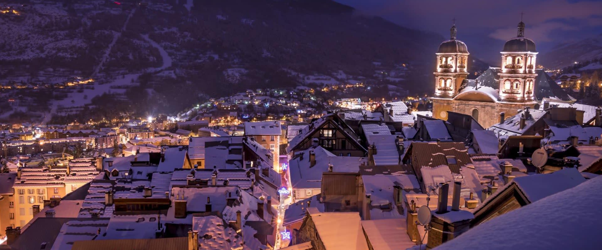
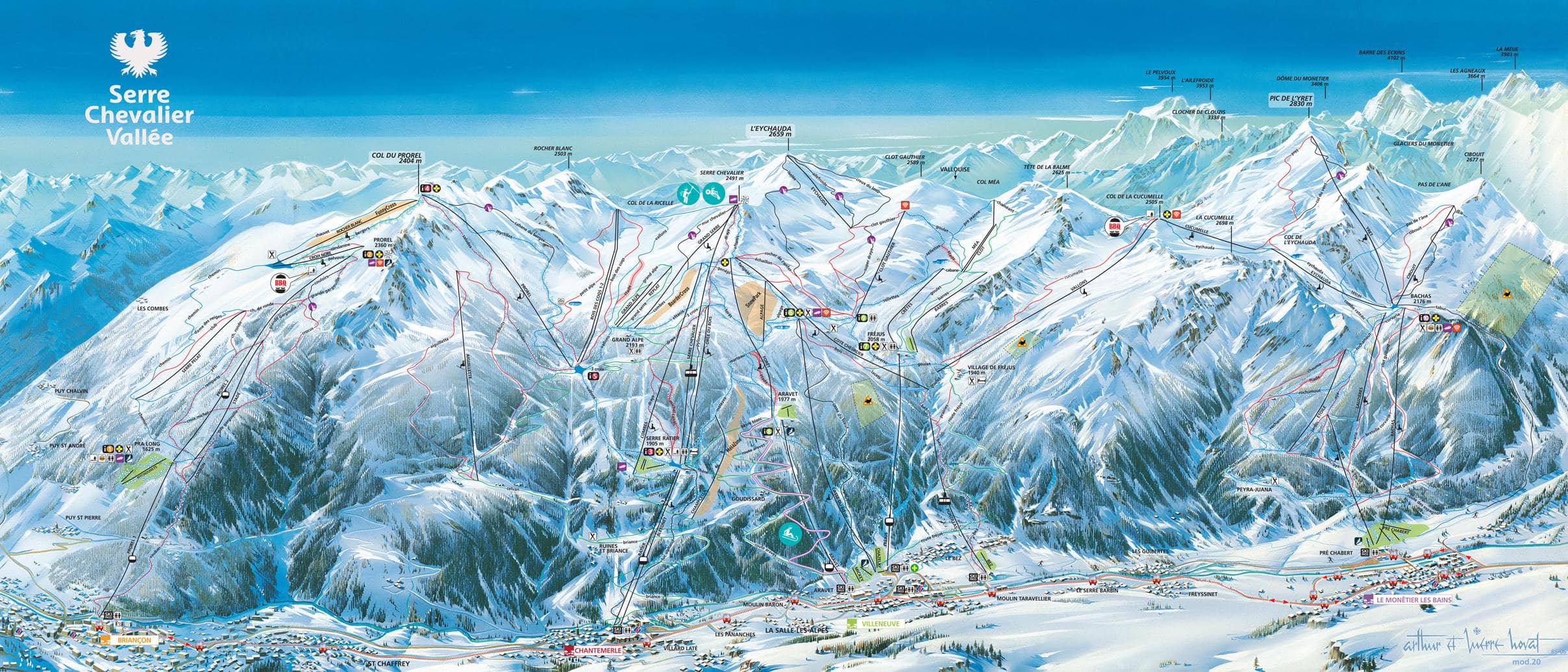
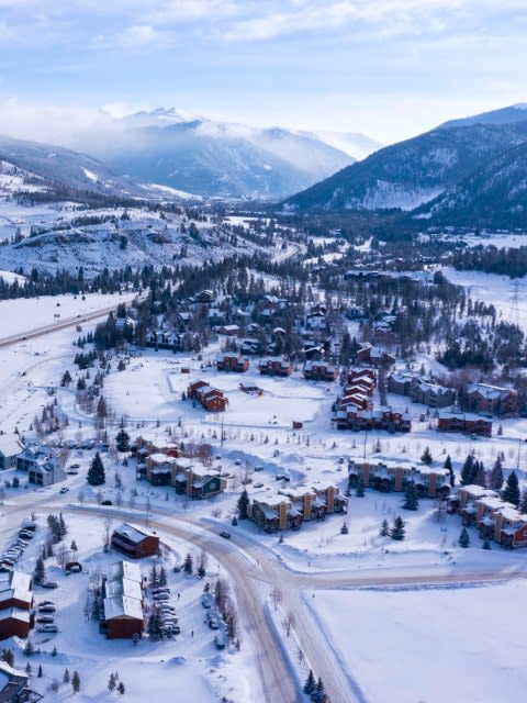
One sheet, one pass, four villages. The map runs along the Guisane valley from the fortified town of Briançon at the low eastern end, through Chantemerle and Villeneuve in the middle, up to Le Monêtier-les-Bains at the top. Everything on it is covered by the single Serre Chevalier ticket — there is no linked neighbour and no bolt-on area to decide about.
That makes it an unusually simple map to read and an unusually long one. The domain stretches roughly 13 km end to end, so where you stay on the valley floor decides most of your week.
Serre Chevalier ski resort guide · Ski resorts in France
Read this one left to right, not bottom to top. The skiing is a single north-facing wall above the valley, with four lift systems climbing it from four different villages and meeting along the ridge — so the question the map answers is not which mountain to ski but how far along the valley to go.
The other thing the sheet shows clearly is the tree line. Serre Chevalier has far more wooded skiing than most French areas of this size, and it runs the length of the map. On a bad-visibility day that is the difference between skiing and sitting in a café.
23 green28 blue37 red16 black104 pistes, 250 km (155 mi), 1,200 m to 2,800 m
The lowest and the most detached-feeling corner of the map, served by a single two-stage gondola out of the town. There is a small beginner area at mid-station and a link along the ridge into the main area, but it is a long way round — Briançon is a brilliant place to stay for the town itself rather than for the ski access.
The first of the two central sectors and the one with the cable car. Above Serre Ratier the ground opens out into the high bowls, and the Luc Alphand black drops the full height back into the village — a World Cup descent named after the local Olympic champion and the most direct line on the sheet.
The densest tangle of lines on the sheet, and the heart of the area. Several gondolas climb from the village to Fréjus and Aravet, the base-area ground is gentle enough for ski schools, and from the top you can traverse in either direction. If you want to ski the whole valley in a week without planning it, this is where to base.
The western tip of the map at 1,500 m, reaching the highest ground in the domain. Coldest snow, fewest people, and the best of the tree-lined reds. It is also the farthest from everything — and it has the thermal baths, which is not nothing after four days of skiing.
Genuinely well served, which is rare on a map this size — 23 greens, and proper beginner zones at the base of both Villeneuve and Monêtier rather than one token nursery slope. Villeneuve is the easier base of the two for a first week.
The map's centre of gravity. Aiguillette and Cucumelle above Chantemerle and Villeneuve are the long sweeping reds worth building a day around, and the tree runs down to Monêtier are the ones to save for weather. Traversing the full length of the valley and back is a satisfying day in itself.
Less about marked blacks than about what sits beside them. Luc Alphand, Casse du Boeuf and the Draye are the steep named lines, but the off-piste between the pistes and the gladed ground above Monêtier are the real draw. Serre Chevalier or Alpe d'Huez is the comparison most people are actually weighing.
Around 30 minutes east over the col, on a different pass and a different map — the Via Lattea, which crosses into Italy. The obvious day trip, and the obvious alternative if you want cross-border skiing.
Over the Col du Lautaret to the north-west, about an hour and a quarter. A glacier resort with a completely different shape of map — one huge vertical face rather than a long valley wall.
Further round the same massif and the usual head-to-head with Serre Chevalier: sunnier, higher, more open, and considerably less wooded.
Package holidays to Serre Chevalier with flights, transfers, accommodation and lift pass, all booked together.
See Serre Chevalier ski holidays


WeSki is a trading name operated by Wetrip Weski Ltd (BR021500). All the flights and flight-inclusive vacations on this website are financially protected by the ATOL scheme. When you pay you will be supplied with an ATOL Certificate. Please ask for it and check to ensure that everything you booked (flights, hotels and other services) is listed on it. Please see our booking conditions for further information or for more information about financial protection and the ATOL Certificate go to: www.caa.co.uk.
Package vacations that do not include travel by air are financially protected via ABTOT.
For the latest travel advice from the Foreign & Commonwealth Office visit www.gov.uk/foreign-travel-advice.
Weski Europe BV (Chamber of Commerce registration number 87334100) is a registered participant of SGR. You can verify this on www.sgr.nl/english. Vacations listed on this website are covered by SGR’s guarantee, within the terms of the SGR guarantee scheme. Under SGR’s guarantee, consumers shall have their prepaid travel sum refunded if their counterparty is unable to fulfill its contractual obligations due to financial inability. Insofar as the agreement includes the transport and the destination has already been reached, the return trip will be arranged.