
EN
EN


This sheet is Val Thorens and Orelle — the top of the Belleville valley plus the fourth valley over the ridge, around 150 km (93 mi) of piste between them. It is one corner of the Three Valleys, which runs to roughly 600 km in total, so Les Menuires, Méribel and Courchevel all sit beyond the edges of this map.
Three different passes cover three different amounts of it: Val Thorens–Orelle, the wider Belleville Valley, and the full Three Valleys. The sheet does not tell you which one you are holding, so it is worth settling that before you book — here is how ski passes work.
Val Thorens ski resort guide · Three Valleys
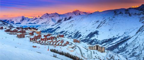
Val Thorens is a bowl, and that is the whole trick to reading this map. The village sits at 2,300 m at the bottom of it with the sectors ringing it on three sides, so almost every run on the sheet feeds back to the same place. You can ski one sector, drop into the village, and start again somewhere completely different without a bus or a long flat traverse — which is not true of most ski areas this size.
The second thing the shape gives you is the sun. Péclet catches it first thing, Plein Sud holds it through the middle of the day, and Cime Caron and Orelle keep it into the afternoon. On a cold week you can plan around that.
11 green27 blue29 red9 black150 km (93 mi), 32 lifts, 2,300 m to 3,230 m
The Funitel climbs to around 3,000 m onto the glacier, and the runs back down are wide, consistent reds — the best early-morning ground on the sheet because it takes the sun first. It is also the sector that stays skiable longest into spring.
The cable car to Cime Caron at roughly 3,200 m is the lift everyone queues for, and rightly: the view is the best in the valley, and the two blacks off the top, Combe de Caron and Combe de Rosaël, are the steepest marked lines on the map. Most of the off-piste people come here for drops off this same ridge.
The blue-dominated side, and where most of a week actually gets skied. Plein Sud and Col de l'Audzin are wide, sunny and busy; the Col de la Chambre at the top is the doorway over to Méribel if you hold the right pass.
Reached by the Grand Fond funitel or the Cime Caron cable car, and far quieter than anything on the Val Thorens side. The Pointe du Bouchet at 3,230 m is the highest skiable point in the whole Three Valleys. Worth knowing before you commit: the link runs back are red, so it is not a sector to send a nervous skier into alone.
Better served than the resort's reputation suggests. The nursery ground sits right in the middle of the village at 2,300 m rather than up a lift, and the Cascades and 2 Lacs runs are a gentle next step. The one thing to avoid early on is Orelle, where the way back is a red.
What the map is built for. Tête Ronde, Christine, Allamande and Jerusalem are the reds worth planning a day around, and Plein Sud and Col de l'Audzin give you wide blue cruising when your legs have had enough. The bowl means you are never far from the village if the weather turns.
Narrower than the size of the area implies — only nine blacks on the sheet. Combe de Caron and Combe de Rosaël are the two that matter, both off the Cime Caron cable car, and the real draw is the off-piste around them. The altitude keeps that snow in better condition for longer than anywhere else in the Three Valleys.
Straight down the Belleville valley on the same pass, lower and cheaper, and the next sheet along. The easiest day trip from Val Thorens and the one most people make.
Over the Col de la Chambre into the middle valley, on the full Three Valleys pass only. Lower, wooded and a completely different feel from the high bare bowl here.
The far valley, two links away and a long but very doable day on the full pass. Worth the trip once in a week rather than as a base for skiing this map.
Package holidays to Val Thorens with flights, transfers, accommodation and lift pass, all booked together.
See Val Thorens ski holidays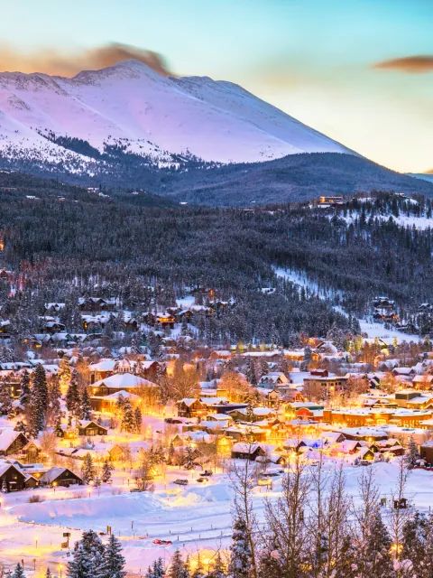


WeSki is a trading name operated by Wetrip Weski Ltd (BR021500). All the flights and flight-inclusive vacations on this website are financially protected by the ATOL scheme. When you pay you will be supplied with an ATOL Certificate. Please ask for it and check to ensure that everything you booked (flights, hotels and other services) is listed on it. Please see our booking conditions for further information or for more information about financial protection and the ATOL Certificate go to: www.caa.co.uk.
Package vacations that do not include travel by air are financially protected via ABTOT.
For the latest travel advice from the Foreign & Commonwealth Office visit www.gov.uk/foreign-travel-advice.
Weski Europe BV (Chamber of Commerce registration number 87334100) is a registered participant of SGR. You can verify this on www.sgr.nl/english. Vacations listed on this website are covered by SGR’s guarantee, within the terms of the SGR guarantee scheme. Under SGR’s guarantee, consumers shall have their prepaid travel sum refunded if their counterparty is unable to fulfill its contractual obligations due to financial inability. Insofar as the agreement includes the transport and the destination has already been reached, the return trip will be arranged.