EN
EN
 Off-slope activities
 Snow-sure resort
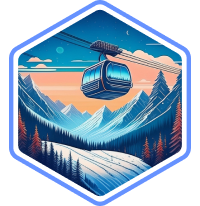 Top facilitiesOff-slope activitiesSnow-sure resortTop facilitiesOff-slope activitiesSnow-sure resortTop facilitiesOff-slope activitiesSnow-sure resortTop facilities
Szczyrk (pronounced roughly "sh-chirk") sits in the Silesian Beskids of southern Poland, about 100km from Kraków. It's one of Poland's most established ski towns, with a history that goes back decades and a local following that fills the slopes on weekends. The resort is split across two main areas: Szczyrk Mountain Resort (Skrzyczne) and COS (the Central Sports Centre), which together provide around 40km of pisted runs on the flanks of Mount Skrzyczne, climbing from 547m up to 1,257m. The season typically runs from mid-December through to late March, and while the altitude is modest by Alpine standards, snowmaking covers a significant portion of the terrain to keep conditions reliable.
The skiing experience here is honest and enjoyable. Szczyrk won't compete with the Alps on scale, but the terrain covers a good spread, from gentle learning slopes to steeper descents that test confident intermediates. Modern high-speed quads have transformed the main Szczyrk Mountain Resort area in recent years, cutting queues and improving the flow across the mountain. For international visitors, the appeal is a different kind of ski holiday altogether: short transfers, strong value, and a genuine Polish mountain-town atmosphere that feels a world away from big commercial resorts further west.
Away from the slopes, Szczyrk has the character of a proper mountain town. The main street is lined with restaurants serving hearty Polish cooking, from żurek soup and oscypek smoked cheese to pierogi and grilled meats, alongside small shops and cafés. The pace is relaxed, the welcome is warm, and the surrounding Beskid mountains provide a beautiful setting for winter walks and exploring. It's a particularly strong choice for families and mixed-ability groups looking for a low-pressure ski holiday with real character.
Check out Szczyrk ski deals to start planning your trip.
Skiing and snowboarding in Szczyrk is spread across two interconnected areas on Mount Skrzyczne. The main Szczyrk Mountain Resort (SMR) side has the lion's share of terrain, with wide, well-groomed runs served by modern high-speed chairlifts that make the most of the 710m vertical drop. The COS area, operated by Poland's Central Sports Centre, has a smaller selection of runs with a slightly more traditional feel and is where you'll find some of the steeper terrain.
Szczyrk's mountain atmosphere is friendly and unhurried. Runs are generally well maintained, with snowmaking backing up natural snowfall across key pistes. The longest run stretches over 5km from top to bottom for a satisfying descent. While the scale is compact compared to the Alps, the quality of skiing and the modern infrastructure mean you can have a thoroughly enjoyable holiday here without feeling short-changed.
Szczyrk is a comfortable place to learn to ski. In the SMR area, the lower slopes have gentle, wide pistes that are ideal for first-timers and early improvers. These areas are served by their own lifts and separated from faster traffic, so beginners can practise at their own pace. When you're ready, progressing from nursery slopes to the mountain's longer, easy runs is gradual and well laid out.
WeSki insider tip: Stick to the lower SMR runs for your first couple of days. They're wide, well-groomed, and catch the afternoon sun, making them ideal for building confidence.
Intermediate skiers will find plenty to enjoy across both ski areas. Longer runs on the SMR side offer satisfying cruising with enough variation in pitch and terrain to keep things interesting. The top-to-bottom descent is a highlight for intermediate skiers. This is a sustained run that rewards smooth technique. Over on the COS side, you'll find the terrain has a bit more character, with some runs that are steep and feel more natural in gradient.
WeSki insider tip: Take the top chairlift on a clear day for views across the Beskid range, then ski the full descent. It's the longest continuous run and one of the most satisfying in the resort.
Advanced skiers will find their options more limited here, but there is terrain that's certainly worth exploring. For steeper pitches, start with the COS area, which includes runs that were historically used for competitive training. The black-graded descents are short but genuinely challenging, with sustained gradients that reward good edge control. On powder days, the tree-lined runs off the main pistes provide some enjoyable off-piste skiing, though the scale is modest.
WeSki insider tip: If you've covered the marked runs, explore the tree lines between pistes on the COS side after fresh snowfall. Here, you'll find some fun, short powder stashes.
Snowboarding in Szczyrk works well on the wider SMR runs, which have enough pitch and space for carving and cruising. The natural terrain features along the edges of pistes add some playfulness, and the tree-lined slopes give a pleasant atmosphere for riding. Szczyrk's modern lift system eliminates the drag-lift frustration that can put boarders off smaller resorts. When you're keen for a freestyle session, a terrain park operates during the season with features for different ability levels.
Off-piste options in Szczyrk are limited compared to larger Alpine resorts, but after a decent snowfall the tree-lined slopes between marked runs can provide some enjoyable powder turns. The COS side tends to hold snow better in the trees. For anything more adventurous, the surrounding Beskid mountains have touring potential, though conditions are variable and local knowledge is advisable.
Several ski schools operate in Szczyrk, with group and private lessons available for all ages and levels. English-speaking instructors can be arranged, though it's worth confirming availability when booking. Lessons are well priced compared to Alpine resorts, making Szczyrk a cost-effective place to learn or improve.
Szczyrk Mountain Resort maintains a terrain park during the season with a mix of features suited to different levels. You'll find boxes, rails, and smaller jumps. While the scale isn't huge, there's enough to keep freestyle-minded skiers and boarders entertained between runs.

Szczyrk is a natural fit for families, especially those with younger children or first-time skiers. The resort's compact layout means slopes, ski school, rental, and restaurants are all clustered around the gondola base, so mornings run smoothly and regrouping during the day is easy. For parents, the pace here is refreshingly relaxed, and the town has a genuine, unhurried atmosphere.
For young kids, a children's zone has a colourful dedicated space with its own practice lifts for a safe and playful introduction to snow. Chairlifts across the resort have child safety systems fitted. "Max the Teddy Bear" Academy runs five-day ski courses for children aged 6 to 16 in small groups of up to five, with warm tea and snacks during breaks and a race with medals at the end of the week. Older children and teenagers will enjoy the terrain park and the longer runs from the summit, which provide enough challenge to keep them engaged. Plus, the five floodlit slopes for night skiing add a different energy to the week.
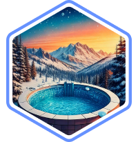
Off the slopes, tubing, ice skating, and swimming pools in town fill rest days, and the surrounding Beskid forests are perfect for family snowshoe walks or simply playing in the snow. Dining is relaxed and family-friendly. You'll find hearty dishes like pierogi, żurek soup, and grilled meats served in cosy mountain restaurants where children are welcome and portions are generous.
Szczyrk's appeal extends beyond the slopes into the surrounding Beskid mountains and the town itself. For rest days or non-skiing members of the group, there's a blend of outdoor activities and cultural experiences that reflect the area's mountain heritage.
The Beskid mountains around Szczyrk provide a beautiful backdrop for winter activities beyond skiing and snowboarding, such as:
For days when you want a break from the mountain, Szczyrk and the surrounding area have plenty to explore:
Dining in Szczyrk is hearty, generous, and rooted in Polish mountain traditions. The town's restaurants lean towards traditional Highlander cuisine, featuring rich stews, grilled meats, handmade pierogi, and warming soups. Portions tend to be large and the atmosphere in most places is welcoming and unpretentious.
WeSki insider tip: Try oscypek, a smoked sheep's cheese that's grilled over charcoal and served with cranberry sauce. It's a Beskid mountain speciality you'll find everywhere in Szczyrk, and it's best eaten fresh from a street vendor or mountain hut.
Szczyrk's après-ski scene is low-key and sociable. At the end of the ski day, you can settle into a warm mountain tavern, order a local beer or a glass of grzaniec (Polish mulled wine), and enjoy the atmosphere. It's relaxed, friendly, and very much in keeping with the town's character.
As the evening progresses, a handful of bars and pubs along the main street tend to pick up the energy. The vibe is informal and welcoming, where you'll often end up chatting with locals and other visitors over drinks. It's the kind of place where a good evening happens naturally rather than being engineered.
Après-ski spots to know:
Accommodation in Szczyrk is spread along the main valley, with options ranging from small family-run guesthouses and pensions to larger hotels with spa facilities. Apartments and self-catering options are widely available, with good value for families and groups. Several hotels include wellness facilities, which are a welcome bonus after a day on the slopes.
The town centre has the highest concentration of restaurants and shops, while properties slightly further out tend to be quieter and often have better views. Wherever you stay in Szczyrk, most accommodation is within walking distance or a short local bus ride from the ski lifts.
The Szczyrk ski pass provides access to the mountain's 11km of pistes, while COS access is usually sold separately, and combined passes are also available. Multi-day and hourly pass options give flexibility depending on how much skiing you plan to do.
Check for family and multi-day pass options when booking your Szczyrk ski holiday through WeSki to find the best fit for your trip.
Equipment rental shops are found at the base of both ski areas and in the town centre. Prices are notably lower than in Alpine resorts, making it a good option for occasional skiers or families who don't want to invest in their own gear. Most shops carry a full range of ski and snowboard equipment, and booking in advance during Polish holiday weeks is advisable to guarantee availability.
Szczyrk is a compact town, and most accommodation is within walking distance of the slopes and restaurants. A local bus service connects the main areas, and the SMR ski area operates its own ski bus during the season. Taxis are available and affordable for getting to the COS area or for evening trips. The town's manageable size means a car isn't necessary for most visitors, though having one opens up easy day trips to Kraków and the wider Beskid region.
The nearest major airports are Katowice (about 80km) and Kraków (about 100km), both served by scheduled airlines from the UK. Poprad Tatry airport is another, further option (195km). The drive from either Katowice or Kraków airport takes around 90 minutes to two hours depending on conditions. Bielsko-Biała, the nearest large town, is just 15km away and well connected by road.
WeSki offers car rentals from the airport as well as private and shared transfers to Szczyrk. Add them to your Szczyrk ski holiday package for seamless door-to-door travel.
Yes, Szczyrk is well suited to beginners. The lower slopes of the SMR area have wide, gentle pistes with their own dedicated lifts, and the progression to longer runs is gradual and well thought out. Ski school options are good and well priced compared to Alpine resorts.
English is not widely spoken in the town, though ski schools can typically arrange English-speaking instructors with advance notice. In hotels and tourist-facing businesses, you'll usually find enough English to get by. Learning a few basic Polish phrases goes a long way and is always appreciated.
Szczyrk is much smaller in scale than major Alpine resorts, with around 40km of pistes compared to hundreds in places like the Three Valleys. However, the modern lift infrastructure, reliable snowmaking, and significantly lower costs make it an appealing option for shorter breaks, families, and beginners. The atmosphere is authentic and the value is excellent.
Very much so. The resort's compact size makes it easy to manage, the learning terrain is well designed for children, and the town has a relaxed, family-friendly atmosphere. Dining and accommodation are affordable, and there are plenty of non-skiing activities to fill rest days.
The season typically runs from mid-December through late March, depending on snow conditions. Snowmaking covers a significant portion of the runs, which helps maintain consistent conditions. The busiest periods are Polish school holidays and weekends.
Kraków is about 100km from Szczyrk, which translates to roughly 90 minutes to two hours by car depending on traffic and road conditions. This makes Kraków an excellent day-trip option and a convenient arrival airport for UK travellers.
Szczyrk is better suited to a long weekend or short break of three to five days rather than a full week of intensive skiing. The terrain covers around 40km across both areas, which keen skiers will explore in a few days. However, combined with the town's non-skiing activities and a day trip to Kraków, a week-long visit can work well for families and mixed groups.


 4.9/5
4.9/5I usually book flights, transfers, hotel, ski rental and lift passes myself but this year used WeSki for a trip to Morzine. It was so much easier. Everything worked perfectly - transfers arrived on time and there was plenty of feedback throughout the whole process giving you confidence the holiday would go smoothly.

A really useful service that is so much easier to use than other 'all-inclusive' sites. It nicely bridges the gap between a travel agent and booking the trip yourself online. I will use WeSki every time I go skiing from now on.
We booked a late minute skiing trip to Morzine through we ski. We looked at booking the trip ourselves but could get anywhere near the price quoted by we ski. The company was excellent and we had no problems at all from start to finish. I would definitely use them to book another weekend skiing trip.
Seamless experience from start to finish. I was spending ages trying to sort out a weekend break and managed to do it with we ski in minutes and for the same price as booking it all up yourself. Flight, transfer and accommodation was all as expected and faultless.
WeSki is a trading name operated by WeTrip Ltd. All the flights and flight-inclusive holidays on this website are financially protected by the ATOL scheme. When you pay you will be supplied with an ATOL Certificate. Please ask for it and check to ensure that everything you booked (flights, hotels and other services) is listed on it. Please see our booking conditions for further information or for more information about financial protection and the ATOL Certificate go to: www.caa.co.uk.
Package holidays that do not include travel by air are financially protected via ABTOT.
For the latest travel advice from the Foreign & Commonwealth Office visit www.gov.uk/foreign-travel-advice.