
Piste maps

Free to download piste maps from the world's best ski resorts
Mountain peaks covered by snow

Featured guides

Panoramic view of the majestic snow-covered Mont Blanc mountain range on a bright, clear day

Chamonix piste map

The Chamonix ski map covers 120 km of pistes across four separate ski areas, none of which connect to each other on skis.
3 min read
Nighttime view of Les Deux Alpes village illuminated with warm lights, surrounded by snowy mountains

Les Deux Alpes piste map

The Les Deux Alpes ski map reads bottom to top rather than side to side: one mountainside, seven sectors stacked above each other, and the gentlest skiing waiting at the very top on the glacier.
3 min read
Night view of Zell am See with its lake reflecting the lights from the town and surrounding snowy mountains

Zell am See piste map

The Zell am See ski map is the Schmittenhöhe above the town — one of three separate mountains on the Zell am See-Kaprun pass, and the only one you cannot ski to from the others.
3 min read
Nighttime scene of Cervinia ski resort, with glowing buildings and snow-covered peaks in the background

Cervinia piste map

The Cervinia ski map crosses an international border at the top rather than the bottom: Italy and Switzerland meet on the glacier at 3,480 m, and the only way between them is over the summit.
3 min read
View of the vast Les Arcs ski area with chairlifts traversing the snowy slopes, surrounded by dramatic mountain peaks

Les Arcs piste map

Four villages stacked up one mountainside at four different altitudes, and a single cable car at the far left of the Les Arcs ski map that doubles the skiing if you buy the bigger pass.
3 min read
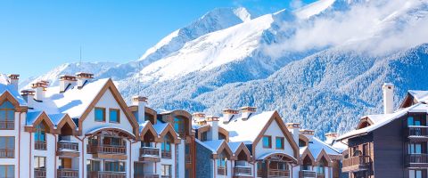
Modern wooden chalets with snowy peaks in the background at Bansko ski resort.

Bansko piste map

There is no skiing in Bansko town at all — the entire Bansko ski map starts 650 m above it, and one gondola is the only way onto the sheet.
3 min read
Traditional chalet-style houses covered in snow with a backdrop of the Tatra Mountains in Zakopane

Zakopane piste map

Zakopane is not one ski area but a town ringed by half a dozen separate hills, most of them on their own ticket — so read the Zakopane ski map as a town map, not a piste map.
3 min read
Wide-angle view of vast snow-covered mountains with ski lifts and pistes under a clear blue sky

Grandvalira piste map

The Grandvalira ski map shows a chain, not a bowl: six gateway villages strung along one valley road, all on a single pass, with the highest and snowiest end furthest from the capital.
3 min read
Layered mountain ranges stretching into the horizon with soft blue tones, under a cloudless sky

Paradiski piste map

The Paradiski ski map is two separate mountains on one sheet, joined by a single cable car across a valley — and if the Vanoise Express is shut, the two halves are an hour apart by road.
3 min read
Misty mountain view with wooden chalets in the snowy village of Samoëns

Samoëns piste map

The Samoëns ski map starts above the village — Samoëns itself sits in the valley below it, and the Grand Massif Express is what puts you on the sheet.
3 min read
Evening view of Zermatt village with the iconic Matterhorn mountain in the background, partially illuminated by soft twilight

Zermatt piste map

Three separate mountains above one village that only join up high, and barely a green run on the whole Zermatt ski map.
3 min read
Panoramic view of snow-covered mountains in Portes du Soleil

Portes du Soleil piste map

The Portes du Soleil ski map is a circuit rather than a mountain: twelve villages in two countries joined in a loop, and the loop only works if you ski it in the right direction with time in hand.
3 min read
Skiers on a wide piste with chairlifts and snow-covered mountains in Pila ski resort, Italy

Pila piste map

The bottom of the Pila ski map is a city: the resort sits on a balcony above Aosta, and the cable car from the station is how you get onto the sheet.
3 min read
Wooden chalets in Alpe d'Huez during sunset, with snow-covered mountains in the background.

Alpe d'Huez piste map

The Alpe d'Huez ski map is one vast south-facing amphitheatre with the resort in the middle of it, four satellite villages hanging off the edges, and a 16 km black run off the top.
3 min read
Sunset view of snow-covered chalets and buildings in Les Menuires

Les Menuires piste map

The Les Menuires ski map is one of the Three Valleys, not all of it: the Belleville valley, with two ridges facing each other and the rest of the area over the top of each one.
3 min read
Expansive view of snowy mountain ranges at Val d'Isère, stretching into the distance.

Val d'Isère piste map

The Val d'Isère ski map is three separate faces above one long village, each with its own lift out of town, and Tignes over the ridge on the same pass.
3 min read
Snowy mountain range with pine-covered slopes in Borovets

Borovets piste map

The Borovets ski map has three sectors from one village, and only one of them — the gondola spine up to Yastrebets — carries the skiing people come for.
3 min read
Passo Tonale summer sunset time

Passo Tonale piste map

The Passo Tonale ski map splits across a mountain pass with the village on top of it — sunny and gentle to the north of the road, glacier to the south.
3 min read
Skiers enjoying the slopes on a wide, groomed piste under bright skies.

Saint Gervais piste map

The town is a spa resort at 850 m with no snow in it — the Saint Gervais ski map begins at Le Bettex, and from there it runs all the way across to Megève one way and Les Houches the other.
3 min read
Vast snow-capped mountain range with blue skies and clouds, featuring dramatic ridges and valleys.

Wengen piste map

A car-free village reached only by cog railway, and a Wengen ski map where the trains are lifts — you ride them up, down and between sectors all week.
3 min read
A picturesque snow-covered alpine village with a tall church steeple, backed by dramatic snowy mountain peaks.

Niederau piste map

The Niederau ski map covers the far western end of Ski Juwel, two villages away from the gondola that links the area's two valleys together.
3 min read
Serene snow-covered landscape in Livigno, with traditional alpine houses beside a calm river and mountain views

Livigno piste map

The Livigno ski map is two mountains facing each other across a long valley town, with a bus along the bottom — which side you are on in the morning decides your day.
3 min read
Alpine mountain peaks glowing orange as the sun sets, with a snowy foreground and trees

Montgenèvre piste map

The Montgenèvre ski map straddles the French-Italian border on a road pass, with skiing on both sides of it — and the Italian half needs the bigger ticket.
3 min read
Courmayeur ski village illuminated at night, nestled within a mountain valley

Courmayeur piste map

You cannot ski back to the village. The town sits 1,224 m below everything on the Courmayeur ski map, and the cable car is the only way up and the only way home.
3 min read
Snowy mountain peaks under a bright sun with a skier and bird in view.

Milky Way piste map

The Milky Way ski map is a long thin chain of five villages across two countries, and the links at the western end are the ones that decide whether you get home on skis.
3 min read
Chamonix lake and mountains view

Les Houches piste map

The Les Houches ski map is the lowest and most wooded sheet in the Chamonix valley, which is exactly why it is the one you want when the high mountains are shut.
3 min read
Aerial view of the unique cliff-top village of Avoriaz, surrounded by snowy peaks, with ski runs and mountain lodges in sight

Avoriaz piste map

The only village actually sitting on the Portes du Soleil circuit, which is why every run on the Avoriaz ski map comes back to your front door.
3 min read
A stunning view of snow-capped mountains with pink-tinted clouds as the sun sets, casting a warm glow over the peaks

Pas de la Casa piste map

The Pas de la Casa ski map covers the highest corner of Grandvalira, right on the French border, which is why it gets the snow first and keeps it longest.
3 min read
Night view of Tignes with its warm lights glowing across snow-covered chalets and modern ski resort buildings

Tignes piste map

The Tignes ski map is shared with Val d'Isère, and the Tignes half is the higher, barer, snowier side of it — with a glacier at the top that skis into the summer.
3 min read
Mayrhofen village surrounded by dense snow-capped forests and mountains in soft evening light

Mayrhofen piste map

The town is at 630 m with no snow in it, and the whole Mayrhofen ski map sits a gondola ride above — on two separate mountains that do not meet.
3 min read
Snow-covered village with church steeple and distant ski slopes in Megève

Megève piste map

Three separate hills around one village, none of them steep, all of them facing Mont Blanc — the Megève ski map is built for cruising, not for pitch.
3 min read
Saalbach village glowing at dusk, nestled between snow-covered alpine peaks

Saalbach piste map

The Saalbach ski map is a circuit you can ski all the way round in a day, with villages along the valley floor and runs falling in from both sides of it.
3 min read
Aerial view of La Plagne village nestled among forested slopes and snowy mountains on a bright winter day

La Plagne piste map

Ten villages arranged around one central bowl, and a glacier behind it — which is why almost everything on the La Plagne ski map is blue and the one hard bit is tucked out of sight.
3 min read
Village of Morzine with traditional chalets scattered across the snow-covered hillside

Morzine piste map

The Morzine ski map covers Les Gets too, and the slopes above the town are split in two by the valley running through the middle of it.
3 min read
Italian Alps winter landscape with snowy mountain peaks on the background

Bardonecchia piste map

Three separate mountains around one town, none of them linked on skis — the Bardonecchia ski map is a town map with ski areas attached, not a single domain.
3 min read
Snow-covered chalets in La Clusaz on a forested mountainside

La Clusaz piste map

Five small massifs ringed around one village, which is why the La Clusaz ski map looks busier than its size and why the snow varies so much across it.
3 min read
Mountain landscape at Flaine ski resort, featuring rugged peaks and a wide expanse of snowy terrain.

Flaine piste map

The Flaine ski map is a single snow-catching bowl with the resort built at the bottom of it, sitting at one end of the Grand Massif horseshoe.
3 min read
Sunset over Bielovodská Valley in the High Tatras, Slovakia, with layered mountain silhouettes and dense pine forest in the foreground

Jasná piste map

The Jasná ski map is one mountain with skiing on both sides of it, and the summit ridge is the only place the two halves meet — which is awkward, because that ridge closes in wind.
3 min read
Picturesque snow-covered village with mountain backdrop at sunset in Val Gardena

Val Gardena piste map

The Val Gardena ski map is one valley, three villages and mountains on both sides — and from the top of either side the Sella Ronda circuit opens up on the same pass.
3 min read
A dense forest of snow-covered pine trees on a mountain slope, viewed from a distance.

Obergurgl piste map

Austria's highest parish, two villages 400 m apart in altitude joined by a gondola over the valley, and almost nothing on the Obergurgl ski map below 2,000 m.
3 min read
Majestic rocky mountains covered in snow, basking in the pink hues of dawn

St Anton am Arlberg piste map

Austria grades without green, so every easy run on the St Anton ski map is drawn blue — and these blues are steeper than blues almost anywhere else.
3 min read
Sunlit snow-covered mountain peaks with a deep valley filled with pine trees

Sestriere piste map

The Sestriere ski map runs the whole Via Lattea, but Montgenèvre at the far French end is only on your pass if it runs to six days or more.
3 min read
Night view of illuminated buildings and church in Serre Chevalier

Serre Chevalier piste map

Four villages strung along 13 km of the Guisane valley on one pass, which is why the Serre Chevalier ski map is read left to right rather than bottom to top.
3 min read
A panoramic view of Val Thorens village at dusk, with buildings lit up against a snowy mountainside.

Val Thorens piste map

Val Thorens is a bowl with the village at the bottom of it, so almost every run on the Val Thorens ski map feeds back to the same place.
3 min read
Alpine chalets and skier on the slopes in Méribel

Méribel piste map

Méribel is the middle valley, so the Méribel ski map is the only sheet in the Three Valleys with a link out of both sides.
3 min read
A tranquil blue lake with snow-capped mountains in the background.

Banff Sunshine piste map

The Banff Sunshine ski map is graded North American style, so a blue square here sits somewhere between a European blue and a European red.
3 min read
Aerial view of Pal-Arinsal with its illuminated village snuggled in the Pyrenees mountains

Pal Arinsal piste map

You cannot ski between Pal and Arinsal — a cable car over the ridge is the only link, which is the first thing to know when reading the Pal Arinsal ski map.
3 min read
Panoramic view of the majestic snow-covered Mont Blanc mountain range on a bright, clear day

Chamonix piste map

The Chamonix ski map covers 120 km of pistes across four separate ski areas, none of which connect to each other on skis.
3 min read
Nighttime view of Les Deux Alpes village illuminated with warm lights, surrounded by snowy mountains

Les Deux Alpes piste map

The Les Deux Alpes ski map reads bottom to top rather than side to side: one mountainside, seven sectors stacked above each other, and the gentlest skiing waiting at the very top on the glacier.
3 min read
Night view of Zell am See with its lake reflecting the lights from the town and surrounding snowy mountains

Zell am See piste map

The Zell am See ski map is the Schmittenhöhe above the town — one of three separate mountains on the Zell am See-Kaprun pass, and the only one you cannot ski to from the others.
3 min read
Nighttime scene of Cervinia ski resort, with glowing buildings and snow-covered peaks in the background

Cervinia piste map

The Cervinia ski map crosses an international border at the top rather than the bottom: Italy and Switzerland meet on the glacier at 3,480 m, and the only way between them is over the summit.
3 min read
View of the vast Les Arcs ski area with chairlifts traversing the snowy slopes, surrounded by dramatic mountain peaks

Les Arcs piste map

Four villages stacked up one mountainside at four different altitudes, and a single cable car at the far left of the Les Arcs ski map that doubles the skiing if you buy the bigger pass.
3 min read
Modern wooden chalets with snowy peaks in the background at Bansko ski resort.

Bansko piste map

There is no skiing in Bansko town at all — the entire Bansko ski map starts 650 m above it, and one gondola is the only way onto the sheet.
3 min read
Traditional chalet-style houses covered in snow with a backdrop of the Tatra Mountains in Zakopane

Zakopane piste map

Zakopane is not one ski area but a town ringed by half a dozen separate hills, most of them on their own ticket — so read the Zakopane ski map as a town map, not a piste map.
3 min read
Wide-angle view of vast snow-covered mountains with ski lifts and pistes under a clear blue sky

Grandvalira piste map

The Grandvalira ski map shows a chain, not a bowl: six gateway villages strung along one valley road, all on a single pass, with the highest and snowiest end furthest from the capital.
3 min read
Layered mountain ranges stretching into the horizon with soft blue tones, under a cloudless sky

Paradiski piste map

The Paradiski ski map is two separate mountains on one sheet, joined by a single cable car across a valley — and if the Vanoise Express is shut, the two halves are an hour apart by road.
3 min read
Misty mountain view with wooden chalets in the snowy village of Samoëns

Samoëns piste map

The Samoëns ski map starts above the village — Samoëns itself sits in the valley below it, and the Grand Massif Express is what puts you on the sheet.
3 min read
Evening view of Zermatt village with the iconic Matterhorn mountain in the background, partially illuminated by soft twilight

Zermatt piste map

Three separate mountains above one village that only join up high, and barely a green run on the whole Zermatt ski map.
3 min read
Panoramic view of snow-covered mountains in Portes du Soleil

Portes du Soleil piste map

The Portes du Soleil ski map is a circuit rather than a mountain: twelve villages in two countries joined in a loop, and the loop only works if you ski it in the right direction with time in hand.
3 min read
Skiers on a wide piste with chairlifts and snow-covered mountains in Pila ski resort, Italy

Pila piste map

The bottom of the Pila ski map is a city: the resort sits on a balcony above Aosta, and the cable car from the station is how you get onto the sheet.
3 min read
Wooden chalets in Alpe d'Huez during sunset, with snow-covered mountains in the background.

Alpe d'Huez piste map

The Alpe d'Huez ski map is one vast south-facing amphitheatre with the resort in the middle of it, four satellite villages hanging off the edges, and a 16 km black run off the top.
3 min read
Sunset view of snow-covered chalets and buildings in Les Menuires

Les Menuires piste map

The Les Menuires ski map is one of the Three Valleys, not all of it: the Belleville valley, with two ridges facing each other and the rest of the area over the top of each one.
3 min read
Expansive view of snowy mountain ranges at Val d'Isère, stretching into the distance.

Val d'Isère piste map

The Val d'Isère ski map is three separate faces above one long village, each with its own lift out of town, and Tignes over the ridge on the same pass.
3 min read
Snowy mountain range with pine-covered slopes in Borovets

Borovets piste map

The Borovets ski map has three sectors from one village, and only one of them — the gondola spine up to Yastrebets — carries the skiing people come for.
3 min read
Passo Tonale summer sunset time

Passo Tonale piste map

The Passo Tonale ski map splits across a mountain pass with the village on top of it — sunny and gentle to the north of the road, glacier to the south.
3 min read
Skiers enjoying the slopes on a wide, groomed piste under bright skies.

Saint Gervais piste map

The town is a spa resort at 850 m with no snow in it — the Saint Gervais ski map begins at Le Bettex, and from there it runs all the way across to Megève one way and Les Houches the other.
3 min read
Vast snow-capped mountain range with blue skies and clouds, featuring dramatic ridges and valleys.

Wengen piste map

A car-free village reached only by cog railway, and a Wengen ski map where the trains are lifts — you ride them up, down and between sectors all week.
3 min read
A picturesque snow-covered alpine village with a tall church steeple, backed by dramatic snowy mountain peaks.

Niederau piste map

The Niederau ski map covers the far western end of Ski Juwel, two villages away from the gondola that links the area's two valleys together.
3 min read
Serene snow-covered landscape in Livigno, with traditional alpine houses beside a calm river and mountain views

Livigno piste map

The Livigno ski map is two mountains facing each other across a long valley town, with a bus along the bottom — which side you are on in the morning decides your day.
3 min read
Alpine mountain peaks glowing orange as the sun sets, with a snowy foreground and trees

Montgenèvre piste map

The Montgenèvre ski map straddles the French-Italian border on a road pass, with skiing on both sides of it — and the Italian half needs the bigger ticket.
3 min read
Courmayeur ski village illuminated at night, nestled within a mountain valley

Courmayeur piste map

You cannot ski back to the village. The town sits 1,224 m below everything on the Courmayeur ski map, and the cable car is the only way up and the only way home.
3 min read
Snowy mountain peaks under a bright sun with a skier and bird in view.

Milky Way piste map

The Milky Way ski map is a long thin chain of five villages across two countries, and the links at the western end are the ones that decide whether you get home on skis.
3 min read
Chamonix lake and mountains view

Les Houches piste map

The Les Houches ski map is the lowest and most wooded sheet in the Chamonix valley, which is exactly why it is the one you want when the high mountains are shut.
3 min read
Aerial view of the unique cliff-top village of Avoriaz, surrounded by snowy peaks, with ski runs and mountain lodges in sight

Avoriaz piste map

The only village actually sitting on the Portes du Soleil circuit, which is why every run on the Avoriaz ski map comes back to your front door.
3 min read
A stunning view of snow-capped mountains with pink-tinted clouds as the sun sets, casting a warm glow over the peaks

Pas de la Casa piste map

The Pas de la Casa ski map covers the highest corner of Grandvalira, right on the French border, which is why it gets the snow first and keeps it longest.
3 min read
Night view of Tignes with its warm lights glowing across snow-covered chalets and modern ski resort buildings

Tignes piste map

The Tignes ski map is shared with Val d'Isère, and the Tignes half is the higher, barer, snowier side of it — with a glacier at the top that skis into the summer.
3 min read
Mayrhofen village surrounded by dense snow-capped forests and mountains in soft evening light

Mayrhofen piste map

The town is at 630 m with no snow in it, and the whole Mayrhofen ski map sits a gondola ride above — on two separate mountains that do not meet.
3 min read
Snow-covered village with church steeple and distant ski slopes in Megève

Megève piste map

Three separate hills around one village, none of them steep, all of them facing Mont Blanc — the Megève ski map is built for cruising, not for pitch.
3 min read
Saalbach village glowing at dusk, nestled between snow-covered alpine peaks

Saalbach piste map

The Saalbach ski map is a circuit you can ski all the way round in a day, with villages along the valley floor and runs falling in from both sides of it.
3 min read
Aerial view of La Plagne village nestled among forested slopes and snowy mountains on a bright winter day

La Plagne piste map

Ten villages arranged around one central bowl, and a glacier behind it — which is why almost everything on the La Plagne ski map is blue and the one hard bit is tucked out of sight.
3 min read
Village of Morzine with traditional chalets scattered across the snow-covered hillside

Morzine piste map

The Morzine ski map covers Les Gets too, and the slopes above the town are split in two by the valley running through the middle of it.
3 min read
Italian Alps winter landscape with snowy mountain peaks on the background

Bardonecchia piste map

Three separate mountains around one town, none of them linked on skis — the Bardonecchia ski map is a town map with ski areas attached, not a single domain.
3 min read
Snow-covered chalets in La Clusaz on a forested mountainside

La Clusaz piste map

Five small massifs ringed around one village, which is why the La Clusaz ski map looks busier than its size and why the snow varies so much across it.
3 min read
Mountain landscape at Flaine ski resort, featuring rugged peaks and a wide expanse of snowy terrain.

Flaine piste map

The Flaine ski map is a single snow-catching bowl with the resort built at the bottom of it, sitting at one end of the Grand Massif horseshoe.
3 min read
Sunset over Bielovodská Valley in the High Tatras, Slovakia, with layered mountain silhouettes and dense pine forest in the foreground

Jasná piste map

The Jasná ski map is one mountain with skiing on both sides of it, and the summit ridge is the only place the two halves meet — which is awkward, because that ridge closes in wind.
3 min read
Picturesque snow-covered village with mountain backdrop at sunset in Val Gardena

Val Gardena piste map

The Val Gardena ski map is one valley, three villages and mountains on both sides — and from the top of either side the Sella Ronda circuit opens up on the same pass.
3 min read
A dense forest of snow-covered pine trees on a mountain slope, viewed from a distance.

Obergurgl piste map

Austria's highest parish, two villages 400 m apart in altitude joined by a gondola over the valley, and almost nothing on the Obergurgl ski map below 2,000 m.
3 min read
Majestic rocky mountains covered in snow, basking in the pink hues of dawn

St Anton am Arlberg piste map

Austria grades without green, so every easy run on the St Anton ski map is drawn blue — and these blues are steeper than blues almost anywhere else.
3 min read
Sunlit snow-covered mountain peaks with a deep valley filled with pine trees

Sestriere piste map

The Sestriere ski map runs the whole Via Lattea, but Montgenèvre at the far French end is only on your pass if it runs to six days or more.
3 min read
Night view of illuminated buildings and church in Serre Chevalier

Serre Chevalier piste map

Four villages strung along 13 km of the Guisane valley on one pass, which is why the Serre Chevalier ski map is read left to right rather than bottom to top.
3 min read
A panoramic view of Val Thorens village at dusk, with buildings lit up against a snowy mountainside.

Val Thorens piste map

Val Thorens is a bowl with the village at the bottom of it, so almost every run on the Val Thorens ski map feeds back to the same place.
3 min read
Alpine chalets and skier on the slopes in Méribel

Méribel piste map

Méribel is the middle valley, so the Méribel ski map is the only sheet in the Three Valleys with a link out of both sides.
3 min read
A tranquil blue lake with snow-capped mountains in the background.

Banff Sunshine piste map

The Banff Sunshine ski map is graded North American style, so a blue square here sits somewhere between a European blue and a European red.
3 min read
Aerial view of Pal-Arinsal with its illuminated village snuggled in the Pyrenees mountains

Pal Arinsal piste map

You cannot ski between Pal and Arinsal — a cable car over the ridge is the only link, which is the first thing to know when reading the Pal Arinsal ski map.
3 min read